Geophysical Interpretation
Accurate assessments of archaeological remains
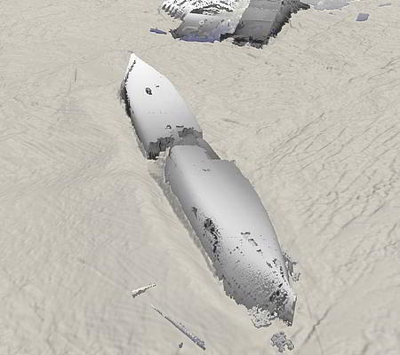
Marine geophysics is a non-invasive, efficient remote-surveying technique to interpret submerged landscapes and marine cultural material such as wrecks and debris from ships and aircraft.
Geophysical instruments can detect buried features and artefacts, but systematic interpretation requires a knowledge both of the archaeological record and of the way it is expressed geophysically.
How marine geophysics works
Marine geophysics uses a variety of systems to comprehensively map, measure and analyse variations in physical properties of the earth’s surface and sub-surface.
In the marine environment, this allows us to interpret and characterise individual objects as well as submerged landscapes dating from when sea-levels were lower than present day, and to give an insight into the archaeological potential of a specific area.
We can:
- undertake geophysical surveys where archaeology is the primary objective.
- interpret geophysical data for coastal and offshore developments, including data acquired for geological, engineering or unexploded ordnance (UXO) assessment.
- provide archaeological mitigation strategies based on geophysical interpretation.
- advise on technical specification for surveys.
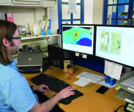
The Geophysics Marine Team
Our team of experienced geophysicists is the largest in Europe and has many years of experience undertaking archaeological assessments of marine geophysical data.
With a range of backgrounds including archaeology, geology and geophysics, our highly qualified multi-disciplinary team undertake all aspects of geophysical data acquisition and assessment, and we pride ourselves on the high quality we deliver.