Marine Fieldwork
Safe and cost-effective marine investigation
Trident Archäologie offers an integrated range of services relevant to the marine environment and associated marine planning systems. We have the largest capacity globally in this area, supporting projects of any size in a diverse range of sectors.
Our team is experienced and knowledgeable in effectively interpreting and characterising potential archaeological features and submerged landscapes on shore and underwater, building up a clear picture for you about the subsequent management or mitigation works likely to be required.
We use the latest technology to capture data and record submerged archaeological landscapes, features, wrecks, artefacts and associated buildings. This creates a lasting, comprehensive record of the historic environment, so that you can deliver a high-quality product to the Planning Authority and the public.
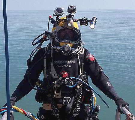
Diving & ROV Investigation
Our clients benefit from a unique one-stop solution when dealing with underwater cultural heritage, because our fully qualified divers are also experienced maritime archaeologists, something that few other providers can match.
We work cost effectively with developers and national curators, while meeting the highest standards of assessment, investigation and mitigation.

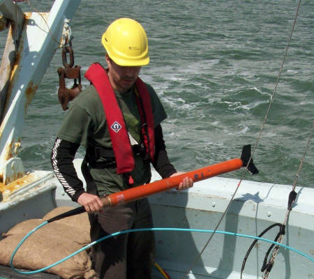
Borehole Drilling Survey
We are experienced in carrying out geoarchaeological borehole drilling surveys. These surveys use site investigation methods to extract core soil samples across a site, allowing for a picture to be built up of how the site has formed over time, and to identify any layers, features or areas which might be archaeologically significant.
Borehole drilling tends to be carried out at the early stages of a project, alongside or as part of Ground Investigation works. The results are often used to construct or update a deposit model for the site, and can be instrumental in ensuring that any subsequent intrusive works such as archaeological evaluation trenching or mitigation works are targeted and proportionate.
Marine Geophysical Survey
We undertake geophysical surveys where archaeology is the primary objective, with all parameters set optimally to detect archaeological features and sites.
Our team of experienced geophysicists is the largest in Europe and has many years of experience undertaking marine geophysical surveys. With a range of backgrounds including archaeology, geology and geophysics, our highly qualified multi-disciplinary team undertake all aspects of geophysical data acquisition and assessment, and we pride ourselves on the high quality we deliver.

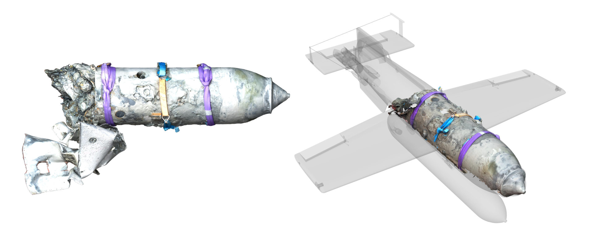
Marine Digital 3D Survey
We use georeferenced 3D photogrammetry for pre-disturbance surveys, making ROV and diver interventions more efficient and therefore less costly. This method is extremely useful for archaeological sites in the intertidal zone, where the survey time available is often very short, and for recording large objects found during dredging and other works.
We have a full suite of photographic equipment suitable for underwater 3D mapping, together with comprehensive survey equipment for georeferencing. Our powerful workstations and software mean we can process data quickly, both in the office and in the field.
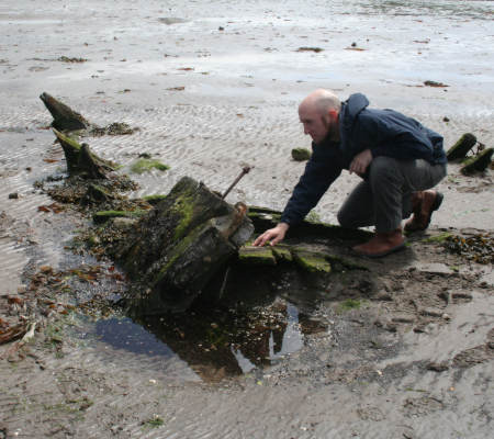
Coastal & Intertidal Fieldwork
Trident is experienced and knowledgeable in examining submerged and foreshore heritage in intertidal and still water environments, river banks and streams and canal or canalside structures.
Our professionals can help in any aspect of fieldwork including wading, diving, walkovers, recording archaeological features by hand or using the latest technology, collecting environmental samples and interpreting and presenting results.